Back نهر بارو Arabic Baro (suba sa Etyopiya) CEB Baro (Fluss) German Baro French बारो नदी Hindi Baro (rijeka) Croatian Baro (rzeka) Polish Rio Baro Portuguese Баро (река) Russian Baro (rijeka) Serbo-Croatian
| Baro River/Openo River in local language of the Anyuwaa people | |
|---|---|
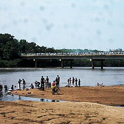
 Akobo Bridge in Gambela | |
 | |
| Location | |
| Countries | |
| Physical characteristics | |
| Source | Birbir River |
| • location | Dibdib, Ethiopia |
| • coordinates | 7°42′04″N 35°52′44″E / 7.701°N 35.879°E |
| • elevation | 2,367 m (7,766 ft) |
| 2nd source | Gebba River |
| • location | Acchiscio, Ethiopia |
| • coordinates | 7°47′13″N 35°50′38″E / 7.787°N 35.844°E |
| • elevation | 2,267 m (7,438 ft) |
| Source confluence | |
| • location | Seriti, Ethiopia |
| • coordinates | 8°14′28″N 34°57′39″E / 8.2411°N 34.9609°E |
| • elevation | 557 m (1,827 ft) |
| Mouth | Sobat River |
• location | Ajungmir, South Sudan |
• coordinates | 8°26′05″N 33°13′13″E / 8.4346°N 33.2202°E |
• elevation | 404 m (1,325 ft) |
| Length | 308.5 km (191.7 mi) |
| Basin size | 21,190 km2 (8,180 sq mi) |
| Basin features | |
| Progression | Sobat River → White Nile → Nile → Mediterranean Sea |
| River system | Nile |

The Baro River (Amharic: ባሮ ወንዝ) or Baro/Openo Wenz, known to the Anuak as Openo River, is a river in southwestern Ethiopia, which defines part of Ethiopian border with South Sudan. From its source in the Ethiopian Highlands it flows west for 306 kilometres (190 mi) to join the Pibor River. The Baro-Pibor confluence marks the beginning of the Sobat River, a tributary of the White Nile.[1]
The Baro and its tributaries drain a watershed 41,400 km2 (16,000 sq mi) in size. The river's mean annual discharge at its mouth is 241 m³/s (8,510 ft³/s).[2]
- ^ Merriam-Webster's Geographical Dictionary. Merriam-Webster. 1997. p. 115. ISBN 0-87779-546-0.; online at Google Books
- ^ Shahin, Mamdouh (2002). Hydrology and Water Resources of Africa. Springer. pp. 276, 287. ISBN 1-4020-0866-X.; online at Google Books